ExifTool Version Number :
12.50
File Modification Date/Time :
2026:05:03 22:37:18+00:00
File Access Date/Time :
2026:05:03 22:37:18+00:00
File Inode Change Date/Time :
2026:05:03 22:37:18+00:00
File Permissions :
crw-rw-rw-
ExifTool Version Number :
12.50
File Name :
sml_U5189.1538152114.0.jpg
File Modification Date/Time :
2019:11:28 03:02:21+00:00
File Access Date/Time :
2026:05:13 00:16:24+00:00
File Inode Change Date/Time :
2026:03:31 17:27:01+00:00
File Permissions :
-rw-r--r--
File Type Extension :
jpg
Exif Byte Order :
Little-endian (Intel, II)
Subfile Type :
Reduced-resolution image
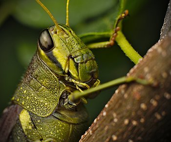
Image Description :
scudderua texensis
Camera Model Name :
LEICA SL (Typ 601)
Orientation :
Unknown (0)
Modify Date :
2018:09:28 11:07:50
Exposure Program :
Manual
Date/Time Original :
2018:09:27 09:01:49
Create Date :
2018:09:27 09:01:49
Components Configuration :
Y, Cb, Cr, -
Exposure Compensation :
0
Flash :
Off, Did not fire
Warning :
[minor] Possibly incorrect maker notes offsets (fix by -2030?)
Focus Distance :
65.535 m
Film Mode :
D.��F.��H.J.p.
WB RGB Levels :
0.9972324723 0.9990791897 1.004621072
Internal Serial Number :
....��YC�..
Sensing Method :
One-chip color area
File Source :
Digital Camera
Digital Zoom Ratio :
undef
Focal Length In 35mm Format :
100 mm
Scene Capture Type :
Standard
GPS Altitude Ref :
Above Sea Level
GPS Time Stamp :
14:01:48
GPS Status :
Measurement Active
GPS Measure Mode :
3-Dimensional Measurement
GPS Date Stamp :
2018:09:27
Date Time :
2018:09:28 11:00:34
Date/Time Digitized :
2018:09:27 09:01:49
Subject :
Texas bush katydid, macro, scudderia texensis
Hierarchical Subject :
Texas bush katydid, macro, scudderia texensis
Encoding Process :
Progressive DCT, Huffman coding
Y Cb Cr Sub Sampling :
YCbCr4:2:0 (2 2)
Scale Factor To 35 mm Equivalent:
1.0
GPS Altitude :
0 m Above Sea Level
GPS Date/Time :
2018:09:27 14:01:48Z
GPS Latitude :
32 deg 45' 12.63" N
GPS Longitude :
97 deg 8' 52.86" W
Circle Of Confusion :
0.030 mm
Depth Of Field :
inf (25.47 m - inf)
Field Of View :
20.4 deg (23.56 m)
Focal Length :
100.0 mm (35 mm equivalent: 100.0 mm)
GPS Position :
32 deg 45' 12.63" N, 97 deg 8' 52.86" W
Hyperfocal Distance :
41.60 m