ExifTool Version Number :
12.50
File Modification Date/Time :
2025:10:18 06:16:57+00:00
File Access Date/Time :
2025:10:18 06:16:57+00:00
File Inode Change Date/Time :
2025:10:18 06:16:57+00:00
File Permissions :
prw-------
File Type Extension :
jpg
Displayed Units X :
inches
Displayed Units Y :
inches
Current IPTC Digest :
f4dae20de9904592de77348f20e786b7
Coded Character Set :
UTF8
Application Record Version :
4
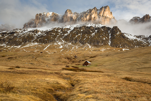
Object Name :
Col di Lana
Keywords :
Belluno, Col di Lana, Dolomieten, Dolomites, Dolomiti, Europe, Hill, Italie, Italië, NP, Travel, Travel Italy, UNESCO World Heritage Site, Unesco, Valley, Veneto, business, business / industry, cloud, cloud forest, clouds, horizontal, house, hut, industries, industry, landscape, majestic, mountain, mountain peak, mountains, nature, no person, orange, outdoor, outdoors, panoramic, red, rock, scenic, sky, snow, sunrise, time tourism
Digital Creation Date :
2017:05:13
Digital Creation Time :
06:36:12
Country-Primary Location Code :
IT
Country-Primary Location Name :
Italië
Copyright Notice :
www.jeroenflorijn.com
Caption-Abstract :
Last snow of the year on Col di Lana, Dolomites, Italy.
Photoshop Thumbnail :
(Binary data 16311 bytes, use -b option to extract)
IPTC Digest :
f4dae20de9904592de77348f20e786b7
Exif Byte Order :
Little-endian (Intel, II)
Image Description :
Last snow of the year on Col di Lana, Dolomites, Italy.
Camera Model Name :
Canon EOS 5D Mark III
Software :
Adobe Photoshop Lightroom 6.8 (Macintosh)
Modify Date :
2017:06:10 08:57:16
Copyright :
www.jeroenflorijn.com
Exposure Program :
Aperture-priority AE
Sensitivity Type :
Recommended Exposure Index
Recommended Exposure Index :
100
Date/Time Original :
2017:05:13 06:36:12
Create Date :
2017:05:13 06:36:12
Shutter Speed Value :
1/100
Exposure Compensation :
0
Metering Mode :
Multi-segment
Sub Sec Time Original :
45
Sub Sec Time Digitized :
45
Focal Plane X Resolution :
1600
Focal Plane Y Resolution :
1600
Focal Plane Resolution Unit :
cm
Scene Capture Type :
Standard
Serial Number :
043023010559
Lens Model :
Zeiss Distagon T* 1.4/35 ZE
Lens Serial Number :
0000000000
GPS Altitude Ref :
Above Sea Level
GPS Time Stamp :
04:35:50.148
GPS Status :
Measurement Active
GPS Measure Mode :
3-Dimensional Measurement
GPS Dilution Of Precision :
1.7
GPS Img Direction Ref :
Magnetic North
GPS Date Stamp :
2017:05:13
GPS Differential :
No Correction
Compression :
JPEG (old-style)
Profile CMM Type :
Linotronic
Profile Class :
Display Device Profile
Profile Connection Space :
XYZ
Profile Date Time :
1998:02:09 06:49:00
Profile File Signature :
acsp
Primary Platform :
Microsoft Corporation
CMM Flags :
Not Embedded, Independent
Device Manufacturer :
Hewlett-Packard
Device Attributes :
Reflective, Glossy, Positive, Color
Rendering Intent :
Perceptual
Connection Space Illuminant :
0.9642 1 0.82491
Profile Creator :
Hewlett-Packard
Profile Copyright :
Copyright (c) 1998 Hewlett-Packard Company
Profile Description :
sRGB IEC61966-2.1
Media White Point :
0.95045 1 1.08905
Media Black Point :
0 0 0
Red Matrix Column :
0.43607 0.22249 0.01392
Green Matrix Column :
0.38515 0.71687 0.09708
Blue Matrix Column :
0.14307 0.06061 0.7141
Device Mfg Desc :
IEC http://www.iec.ch
Device Model Desc :
IEC 61966-2.1 Default RGB colour space - sRGB
Viewing Cond Desc :
Reference Viewing Condition in IEC61966-2.1
Viewing Cond Illuminant :
19.6445 20.3718 16.8089
Viewing Cond Surround :
3.92889 4.07439 3.36179
Viewing Cond Illuminant Type :
D50
Luminance :
76.03647 80 87.12462
Measurement Observer :
CIE 1931
Measurement Backing :
0 0 0
Measurement Geometry :
Unknown
Measurement Flare :
0.999%
Measurement Illuminant :
D65
Technology :
Cathode Ray Tube Display
Red Tone Reproduction Curve :
(Binary data 2060 bytes, use -b option to extract)
Green Tone Reproduction Curve :
(Binary data 2060 bytes, use -b option to extract)
Blue Tone Reproduction Curve :
(Binary data 2060 bytes, use -b option to extract)
XMP Toolkit :
Adobe XMP Core 5.6-c128 79.159124, 2016/03/18-14:01:55
Creator Tool :
Adobe Photoshop Lightroom 6.8 (Macintosh)
Metadata Date :
2017:06:10 08:57:16+02:00
Lens :
Zeiss Distagon T* 1.4/35 ZE
Date Created :
2017:05:13 06:36:12.45
City :
Livinallongo del col di lana
Document ID :
xmp.did:ed98f796-aa35-40df-ae46-0258205ea79b
Original Document ID :
DA2506D32D0927883EB3EE5BEFA24E8C
Instance ID :
xmp.iid:ed98f796-aa35-40df-ae46-0258205ea79b
Has Extended XMP :
139626F367F8507723376F3BEFE5798E
Rights :
www.jeroenflorijn.com
Description :
Last snow of the year on Col di Lana, Dolomites, Italy.
Subject :
Belluno, Col di Lana, Dolomieten, Dolomites, Dolomiti, Europe, Hill, Italie, Italië, NP, Travel, Travel Italy, UNESCO World Heritage Site, Unesco, Valley, Veneto, business, business / industry, cloud, cloud forest, clouds, horizontal, house, hut, industries, industry, landscape, majestic, mountain, mountain peak, mountains, nature, no person, orange, outdoor, outdoors, panoramic, red, rock, scenic, sky, snow, sunrise, time tourism
History Action :
derived, saved
History Parameters :
converted from image/x-canon-cr2 to image/jpeg, saved to new location
History Instance ID :
xmp.iid:ed98f796-aa35-40df-ae46-0258205ea79b
History When :
2017:06:10 08:57:16+02:00
History Software Agent :
Adobe Photoshop Lightroom 6.8 (Macintosh)
Derived From Document ID :
DA2506D32D0927883EB3EE5BEFA24E8C
Derived From Original Document ID:
DA2506D32D0927883EB3EE5BEFA24E8C
Creator Work URL :
jeroenflorijn.nl
Creator Country :
Nederland
Creator Work Email :
jeroen.anita@ziggo.nl
Warning :
XMP format error (no closing tag for x:xmpmeta)
Encoding Process :
Progressive DCT, Huffman coding
Y Cb Cr Sub Sampling :
YCbCr4:4:4 (1 1)
Scale Factor To 35 mm Equivalent:
19.2
Create Date :
2017:05:13 06:36:12.45
Date/Time Original :
2017:05:13 06:36:12.45
Thumbnail Image :
(Binary data 16311 bytes, use -b option to extract)
GPS Altitude :
2139.1 m Above Sea Level
GPS Date/Time :
2017:05:13 04:35:50.148Z
GPS Latitude :
46 deg 29' 21.47" N
GPS Longitude :
11 deg 49' 52.38" E
Date/Time Created :
2017:05:13 06:36:12
Digital Creation Date/Time :
2017:05:13 06:36:12
Circle Of Confusion :
0.002 mm
Focal Length :
35.0 mm (35 mm equivalent: 672.0 mm)
GPS Position :
46 deg 29' 21.47" N, 11 deg 49' 52.38" E
Hyperfocal Distance :
97.85 m
Lens ID :
Carl Zeiss Distagon T* 35mm f/1.4 ZE